Umphang, Tak 2026 Guide: Thi Lo Su & 1,219 Curves
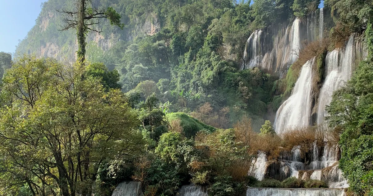
If you want a cool-season trip that is not the same mountains everyone else visits, Umphang is one of the few places that still feels far away: a road with 1,219 curves, a vast forest on the Myanmar border, the Mae Klong River for rafting, and a waterfall often described as Thailand's largest. The remoteness is the price. Plan badly and you lose day one to the curves, then arrive after the waterfall has stopped admitting visitors.
This guide combines several sources and says plainly where they disagree, because Umphang's fees and vehicle rules really do change. Information as of October 2026.
Still choosing a destination? Compare it in the 2026 cool-season trips roundup. If you have read the Pai and Mae Hong Son guide, Umphang is the rawer, quieter version of a winding mountain road trip.
What Umphang is, and who it suits
Umphang is the westernmost district of Tak, inside the Umphang Wildlife Sanctuary, a large protected forest connected to the western forest complex. It is a tiny town reached by one road only: Highway 1090 from Mae Sot.
Good for
- Nature and photography fans who trade convenience for wilderness
- Road-trippers with at least 3 days
- Groups whose kids are old enough to sit through hours of winding road
Not for
- Anyone prone to car sickness (think about 1,219 curves first)
- Weekend-only travellers from Bangkok who are not flying into Mae Sot
- People wanting luxury hotels, restaurant variety or full phone signal everywhere
Getting there: Mae Sot first, then 1,219 curves
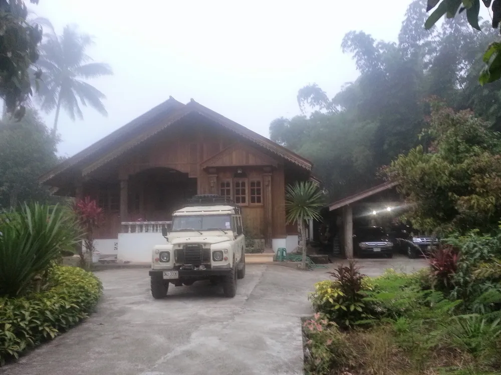 Photo: Maewong Adventure — CC BY-SA 3.0 (Wikimedia Commons)
There is no airport at Umphang and no public transport into the sanctuary. Everything goes through Mae Sot.
| Leg | How | Notes |
|---|---|---|
| Bangkok → Mae Sot | Drive, about 490 km | Roughly 6–7 hours without traffic, via Nakhon Sawan, Kamphaeng Phet, Tak |
| Bangkok → Mae Sot | Fly into Mae Sot (MAQ) | About 1 hour 20 minutes; the airport is about 10 minutes from town |
| Mae Sot → Umphang | Drive, Highway 1090 | About 160–164 km, 3–4 hours, 1,219 curves |
| Umphang → Thi Lo Su | About 45 km unpaved road + walk | Under sanctuary rules, see the waterfall section |
Drive yourself or rent in Mae Sot
If you fly in, rent a car (or hire a van or pickup with a driver) in Mae Sot. Driving all the way from Bangkok is fine, but prepare the car: see the checklist in the car maintenance guide, especially brakes, tyres and engine oil, since the descents last tens of kilometres. More long-drive planning is in the Thailand road trip guide.
Surviving the curves
- Use a low gear on descents; do not ride the brakes or they will fade
- Leave Mae Sot as early as possible so you are not driving the curves in the dark
- Fill the tank in Mae Sot; fuel stops are few
- Bring motion-sickness tablets, and seat susceptible passengers in front
- Signal drops in places, so download offline maps
Real driving time on twisting roads is usually longer than a map suggests, so pad your schedule.
Thi Lo Su waterfall: the highlight to verify every time
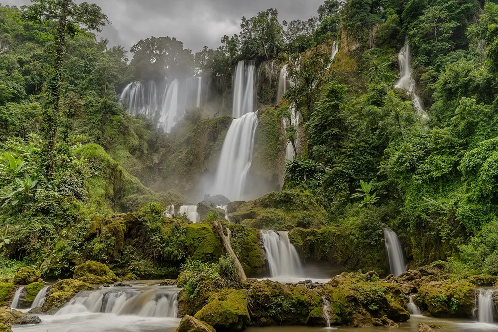 Photo: Snobbird — CC BY-SA 4.0 (Wikimedia Commons)
Thi Lo Su (Karen for "Black Waterfall") is called the largest waterfall in the country, a wide curtain over limestone tiers. Sources give different sizes and note it has never been formally surveyed: roughly 450–500 m wide and 250–300 m high.
Current status: the Umphang Wildlife Sanctuary announced reopening on 1 September 2026. It has closed abruptly before after flash floods and mudslides (closure announced from 22 September 2024), so always phone the sanctuary: 055-508-780 or 088-427-5272 (numbers listed by sources as of October 2026).
Two ways in, depending on the season
| Season | Access | Experience |
|---|---|---|
| Nov–Apr (road open) | 4WD or pickup along about 45 km of unpaved road, then a short walk | Easier; self-driving possible under sanctuary conditions |
| Jun–Oct (road usually closed) | Inflatable-raft trip down the Mae Klong, then a 2–3 hour jungle trek | More adventurous, with leeches and mud; book through an Umphang operator |
The recommended window is November to early December: the water is still high from the rains while the road has reopened. Later in the cool season there is less water and more exposed rock.
Entry fees: the sources disagree
| Item | Figures found |
|---|---|
| Thai adult | 30–40 THB |
| Thai child | about 20 THB |
| Foreign adult | 200–400 THB |
| Foreign child | about 200 THB |
| Car | 60 THB per car |
| Camping | about 30 THB per person per night (one source) |
The ranges are wide because rates follow official announcements and some sites still show old data. Treat them as a rough budget and confirm on the spot or by phone.
Time rules people trip over
- Day visitors buy tickets on site with no booking, but must reach the ticket point (sanctuary headquarters or the Huai Nong Luang unit) before the cut-off, reported as about 14:00, with entry roughly 08:00–15:00.
- Overnight visitors need permission and registration in advance and must arrive by about 16:30. One source says to apply at least 7 days ahead.
- The walk from the drop-off is about 45 minutes per one source; others describe it as shorter, depending on season and where vehicles may park.
Safety: rocks around the pools are very slippery, and drownings and falls have been reported, mostly from climbing to the upper ledges. Swim only in marked areas and never after heavy rain.
Rafting on the Mae Klong
The activity that sets Umphang apart is inflatable-raft rafting on the upper Mae Klong, past limestone cliffs, forest, small waterfalls and a roadside hot spring. Most rapids are gentle, so beginners cope, and in the wet season the same route is the starting point for the walk to Thi Lo Su.
Before you board
- Use a licensed local operator; ask about a guide and life jackets for everyone
- Ask about water levels; heavy rain upstream changes the rapids within hours
- Keep valuables and your phone in a dry bag
- Prices and times vary by route; ask whether the quote includes sanctuary entry (one source says a day tour of about 2,000 THB excludes it)
Doi Hua Mot: sea of mist near town
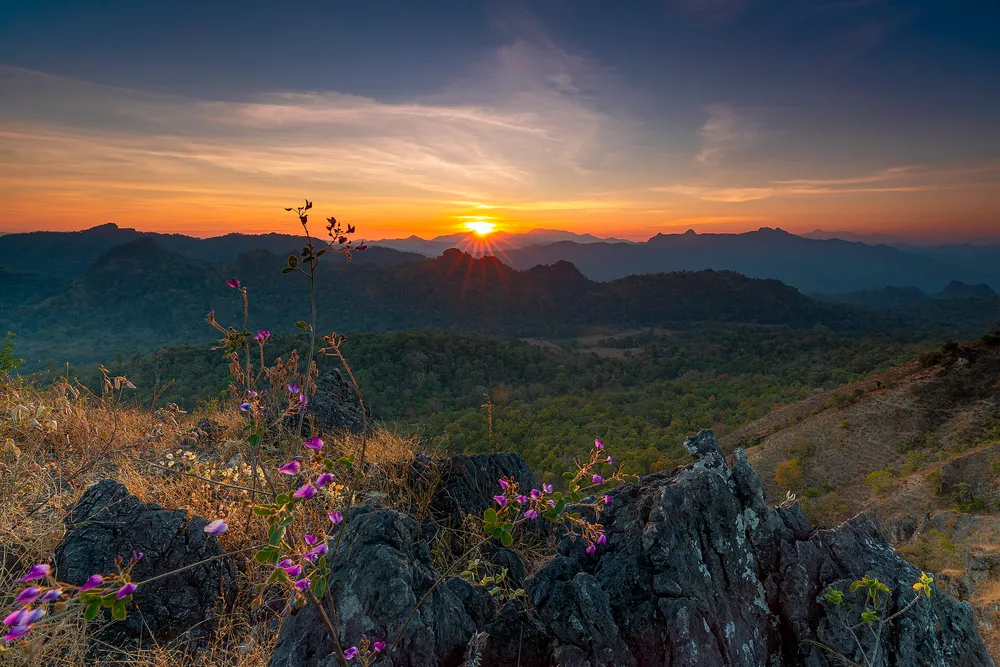 Photo: Snobbird — CC BY-SA 4.0 (Wikimedia Commons)
Doi Hua Mot is a limestone ridge about 5 km from Umphang town according to one source (another cites viewpoints at km 10 and 13, about 30 minutes away, so double-check with your lodging). It is open at all hours and people go around 05:00 for sunrise.
Mist is common from November to February but depends on humidity and cloud, and nobody can guarantee it. Keep a spare morning in your plan.
Another often-mentioned viewpoint near Ban Pa La Ta needs more winding road; an older news report says mist is best around 08:00–09:00, but that is not current, so ask your lodging.
Hot spring and nearby extras
Umphang Hot Spring is on the rafting route and also reachable by road, open about 08:00–17:00 per one source; check road conditions. Pitugro waterfall needs a multi-hour hike and an overnight stay with porters, for adventurous travellers with time. Contact the sanctuary first.
Stop in Mae Sot on the way
Spend half a day before the climb:
- Wat Thai Samakkhi, a Burmese-style temple, open about 05:00–18:00
- Phacharoen Waterfall (Phop Phra), tiered limestone falls with swimming, about 08:00–17:00, closed May–June
- Rim Moei Market, a border trade market; check border status first
- Mae Kasa Hot Spring, about 08:00–18:00
A 3-day, 2-night plan
| Day | Plan |
|---|---|
| Day 1 | Leave Mae Sot in the morning → drive Highway 1090 with rest stops → reach Umphang in the afternoon → check in, stroll the market, ask about Thi Lo Su status → early night |
| Day 2 | Up at 4 for Doi Hua Mot mist → breakfast → Thi Lo Su under the season's access rules, reaching the ticket point before the cut-off → back to lodging |
| Day 3 | Half-day raft or hot spring → leave Umphang before noon to reach Mae Sot before dark |
With 4 days and 3 nights, add a weather buffer day, since both waterfall and rafting depend on rain.
Budget: easier to calculate than to guess
Lodging and food prices in Umphang vary by place and season, and the sources I checked had no reliable 2026 figures, so no prices are invented here. Use this formula:
- Fuel = (round-trip distance ÷ km per litre) × price per litre. Bangkok–Mae Sot–Umphang and back is roughly 1,300 km; at 12 km/l that is about 108 litres (mountain driving uses more, so add margin)
- Thi Lo Su entry = per-person fee × people + 60 THB per car (see table)
- Lodging: request quotes directly; book about a month ahead for November–February
- Rafting/guide: get a written quote from a licensed operator and ask whether entry is included
Mistakes people make
- Trying a one- or two-day round trip: 8 hours of driving leaves under half a day at the falls
- Not checking Thi Lo Su status: it has closed suddenly and the vehicle rules change by season
- Reaching the ticket point late: past the cut-off, you do not get in however far you drove
- Not filling up in Mae Sot
- Booking lodging late: winter rooms in Umphang fill fast
- Swimming near high rocks or after rain, the cause of reported accidents
- Trusting 2022–2024 blog numbers: fees and rules have moved on
Verdict
Go if you have at least 3 days, like raw nature and accept a long journey. It leaves a very different impression from Chiang Mai or Pai. Rating: 4.5/5, half a star off for the uncertainty over waterfall status and travel time.
Skip it if you only have a two-day break, get carsick, or want everything easy. Pick something closer from the cool-season roundup.
Sources
Frequently asked questions
- Is Thi Lo Su waterfall open in 2026?
- According to the Umphang Wildlife Sanctuary and press reports, it reopened on 1 September 2026. Status can change fast after heavy rain or flash floods (it was closed after a mudslide on 22 September 2024), so call before every trip.
- When is the best time to visit Umphang?
- November to February for cooler weather and frequent mist. November to early December is best for the waterfall, as the road reopens while water is still high. From June to October the road to the falls is usually closed and access is by rafting plus a jungle trek with leeches and mud.
- Can I drive to Umphang in a regular sedan?
- Highway 1090 from Mae Sot is paved all the way, so a sedan can reach town, but you need engine braking on the descents. The roughly 45 km of unpaved road from Umphang to Thi Lo Su usually requires a sanctuary-approved pickup or 4WD, so ask about current rules first.
- Is a one-day trip to Umphang realistic?
- Not recommended. The drive from Mae Sot alone is 3–4 hours and the waterfall has limited hours (about 08:00–15:00). Stay at least one or two nights.
- What do I need to book ahead?
- Umphang lodging in November–February, about a month ahead. Camping or overnight stays in the sanctuary need advance permission (one source says at least 7 days). Day visitors can buy tickets on site.
- Is rafting on the Mae Klong dangerous?
- Most rapids are mild and suit beginners, but water levels change with the season. Use a licensed operator, wear a life jacket throughout, and postpone if heavy rain falls upstream.
Related articles
Khao Kho Travel Guide 2026: Sea of Mist, Wat Pha Son Kaew, Fees
Khao Kho, Phetchabun in the cool season 2026: sea of mist at Khao Takhian Ngo, Wat Phra That Pha Son Kaew, Sri Dit Waterfall, fees, stays and a 2-day plan.
Lampang Travel Guide 2026: Horse Carriages, Lampang Luang, 3-Day Plan
Cool-season Lampang guide 2026: Wat Phra That Lampang Luang, Kad Kong Ta, horse carriages, Chae Son hot springs, fees, getting there and a 3-day plan.
Koh Chang & Trat Travel Guide 2026: Ferry, Beaches, 3-Day Plan
Koh Chang in the 2026-27 cool season: getting there from Bangkok, the new ferry fares, White Sand, Kai Bae, Bang Bao, Klong Plu waterfall, Koh Wai, budget and a 3-day plan.