Phu Chi Fa, Chiang Rai 2026: Sea of Mist, Costs, Route and Trip Plan
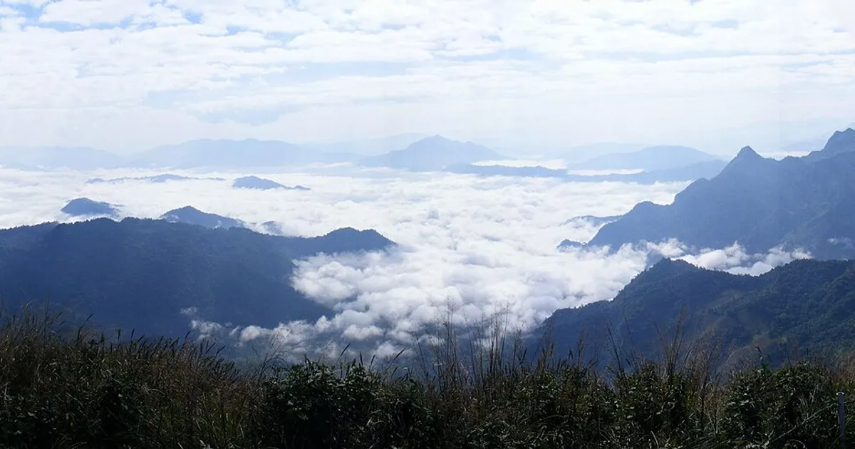
Anyone who wants the pointed ridge leaning toward Laos and a white sea of mist filling the valleys at first light thinks of Phu Chi Fa first. The trip is harder than the photos suggest: a steep drive, a pre-dawn start, real cold, and no guarantee the mist shows up. This guide cross-checks several sources on route, costs, timing, the walk, stays and the border situation so you can plan it yourself. For other cool-season ideas see cool-season trips in Thailand 2026, and for the city side of the province read the Chiang Rai travel guide.
What and where
Phu Chi Fa is in Tap Tao, Thoeng district, Chiang Rai, at the northeastern end of the Phi Pan Nam range. The highest point is about 1,628 m. It belongs to the Doi Pha Mon sub-range that runs along the Thai–Lao border and slopes down to the Mekong. The forest covers about 92.91 km², and the Forest Department restored its forest-park status on 6 February 1998. Some travel sources say it has since been upgraded to a national park, so confirm current rules before you go.
The draw is the pointed ridge facing Laos, layers of mountains, and a sea of mist on good days. This is not a café stop; you earn the view with a little effort.
Best time to go
| Period | What to expect | Good for |
|---|---|---|
| Mid-Oct – mid-Dec | Thickest mist per travel sources; cool to cold | Mist chasers |
| Dec – Feb | Peak season, crowds, very cold mornings, some mist | Winter atmosphere, if you accept crowds |
| Feb – Apr | Possible crop-burning haze; view not clear | Not recommended for the view |
| Rainy season | Slippery dirt path; mist possible but climbing riskier | Experienced visitors only |
Mist depends on each day's temperature, humidity and wind: it is odds, not entitlement. Stay two mornings if you can. For late-season smoke, check the PM2.5 checker and pack a mask using the dust-mask guide.
Getting there from Chiang Rai
By car or scooter
The shortest route is about 85 km, 2–3 hours: Highway 1020, then 1152 and 1421, then 4018 into the hills and onto 1093, following the blue signs. The alternative via Thoeng is about 115 km: Highway 1020 to Thoeng, then 1155 north for about 30 km to meet 1093. It is paved all the way, but the final hour is steep with constant hairpins.
- Do not trust the Google Maps pin alone. One guide warns it can place the viewpoint inside Laos; follow the blue road signs.
- Fill the tank beforehand. Stations are essentially closed before dawn; the guide's last-chance pump is a self-service unit near Khun Tan before the steep forest roads.
- A scooter needs power: at least about 110cc, more with a passenger.
- Cars: rentals need a licence (an International Driving Permit for foreigners); a pickup or sturdy car is more comfortable where the road is rough.
If you drive an EV, plan charging before the climb with the EV trip planner and do not count on charging at the top.
Without your own vehicle
| Option | Cost/time (per guides) | Watch out |
|---|---|---|
| Minivan from Chiang Rai Bus Terminal 1 | About 150 baht one way, around 13:00, 3–4 h | Confirm time and seat by phone; return usually next morning |
| Taxi / private hire | About 1,000–1,300 baht one way, ~90 min | Agree price and arrange the return |
| Scooter rental in Chiang Rai | About 200–300 baht/day | Needs enough power; you buy fuel |
| Bus from Chiang Mai | About 5 h to Thoeng, then ~55 min onward | Few departures; buy early |
Data from travel guides, as of November 2026; times and prices change, so phone ahead.
The viewpoint and the walk
From the car park, walk about 750–790 m up a steep dirt road, 15–45 minutes depending on fitness and crowds. The gain is about 125 m from the upper car park or about 200 m from the lower one; on busy holidays staff may send you to park lower, making the walk about 1.7 km. A guide lists opening hours of about 04:30–18:00 (recheck).
The top is a long flat ridge. The pointed tip is the most crowded; walk a little left for space. There are toilets at the car park but none on top.
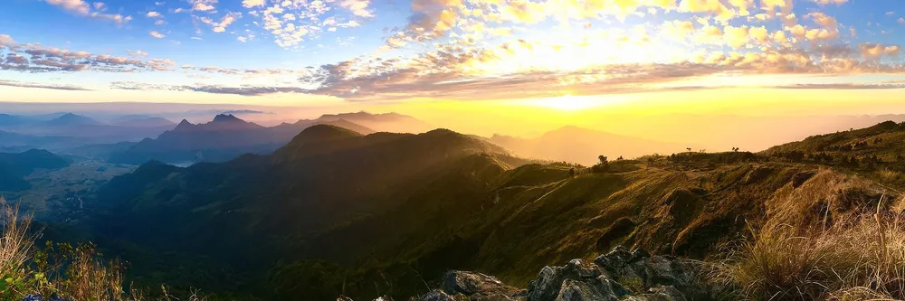 Photo: Photogrammar, CC BY-SA 4.0 via Wikimedia Commons
Timing: sunrise and sunset
- Be at the car park before 05:45 so you have time to walk and find a spot before light. Starting at about 03:00 means a torch, and the top can be below 10 °C.
- Sleep nearby rather than driving from Chiang Rai at 2 a.m. — steep roads on no sleep are the real risk.
- Sunset also works; some prefer it for fewer people and milder temperatures, but be off the mountain before dark.
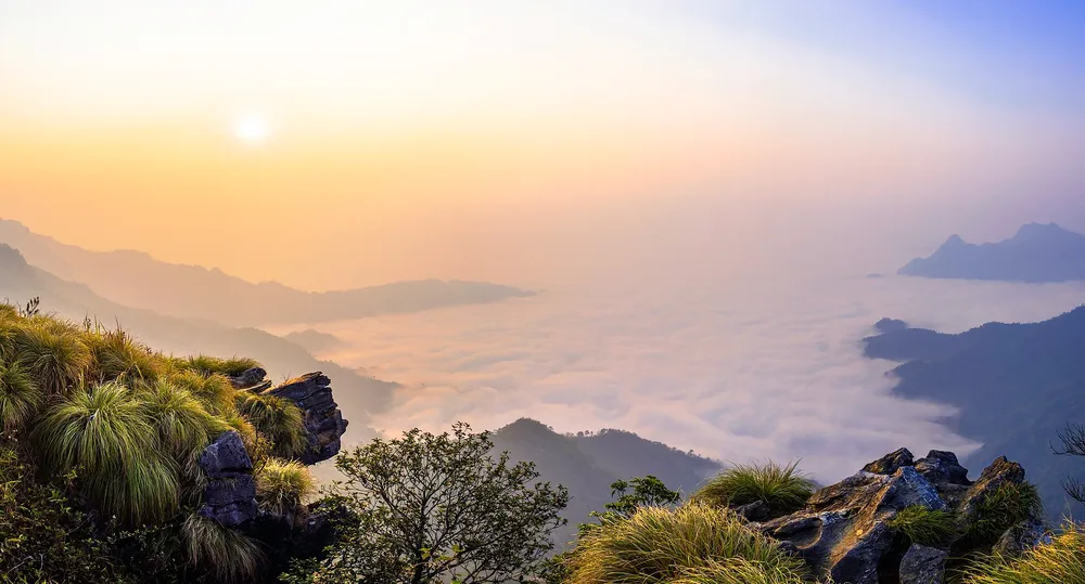 Photo: Pulperm Phungprachit, CC BY-SA 4.0 via Wikimedia Commons
Where to stay and camp
The guides name homestays and resorts near Phu Chi Fa: Chill Chill Camp Phu Chi Fa (small budget bungalows), Maan Fa Hill Phu Chi Fa (bungalows, breakfast, staff can drive you to the car park) and Ban Chomdoi Resort Pha Tang (mountain views, restaurant, viewpoint tours). I found no verifiable prices, so none are quoted — call and compare, and book ahead near year-end.
There are two campsites per the guides: one at the park entrance (reported free, with toilets and hot showers but no food) and one at the Ngao watershed unit, known for wild Himalayan cherry trees blooming around December–January. Bring your own tent, a cold-rated sleeping bag and food.
Doi Pha Tang, a backup viewpoint
Doi Pha Tang (often spelled Doi Pa Tang) is about 12 km away, another border-side mist viewpoint. One source says it is free, but route and parking information is thin, so do not make it your main plan. Ask your accommodation first; border incidents have affected this area too.
 Photo: Wikimedia Commons contributor (Doi Pa Tang 1.jpg), CC BY 3.0
Safety and the border
The viewpoint sits on the Thai–Lao border. It was closed temporarily from 5 May 2025 after clashes in Pakta, Bokeo province, Laos sent stray bullets onto the Thai side, and reopened on 19 May 2025 once things calmed. That comes from news of the time, not a current notice, so:
- Check the park, district or official pages before every trip.
- A marker shows the border on top; photos are fine, but do not cross into Laos without proper documents.
- Go in a group or hire a guide; do not walk alone in the dark.
- If staff tell you to leave or the area closes, comply immediately.
Budget and a 2-day, 1-night plan
| Item | Estimate (baht) | Note |
|---|---|---|
| Scooter, 2 days | 400–600 | From the 200–300/day in guides |
| Fuel | For roughly 170–230 km round trip | Depends on your vehicle |
| Minivan round trip (no driving) | About 300 | From about 150 each way |
| One night's stay | Call to ask | No verified price |
| Parking / pickup | 0–100 | Sources conflict |
| Food, 3 meals | Budget 300–500 per person | My estimate, not sourced |
Sample plan
- Day 1: leave Chiang Rai about 10:00, lunch in Thoeng, fill the tank, reach your stay in the afternoon, and go up for sunset if open. Sleep early.
- Day 2: wake about 04:00, be at the car park before 05:45, walk up for sunrise, have breakfast, pack and head back. In December–January stop at the wild cherry blossoms on the way, arriving in Chiang Rai in the afternoon.
For long weekends check the holiday calendar and long weekends 2027; stays here fill quickly around New Year.
Common mistakes
- Leaving too late and missing first light and the thinning mist.
- No warm layer — under 10 °C and windy on the ridge.
- A small scooter with a passenger that struggles uphill and overheats brakes downhill.
- Running low on fuel with nothing open before dawn.
- Expecting mist every day. Plan two mornings or a backup activity.
- Skipping the border notice before departure.
Verdict: worth it? 4.4 out of 5
Phu Chi Fa is worth it if you go in the right window (late October to December), sleep nearby and pack warm. A ridge pointing into Laos over a sea of mist is a view few places in Thailand offer. The costs are a steep road, the cold, peak-season crowds, inconsistent fee information and a border risk you must check each time. The 4.4 reflects cross-checked sources, not first-hand testing by our team (see About). If you are undecided, start with the Chiang Rai city guide and save Phu Chi Fa for a trip where you truly will get up early.
Sources
Frequently asked questions
- When is the sea of mist best at Phu Chi Fa?
- Travel guides put the thickest mist at about mid-October to mid-December, with some in January–February. February to April often brings crop-burning haze that spoils the view. Mist depends on the day's weather and is never guaranteed.
- Is there an entrance fee for Phu Chi Fa?
- Sources disagree. Some say entry is free; others mention parking of about 40–50 baht and a pickup truck on part of the climb, and the park has reportedly been upgraded to national park status. Carry small cash and ask the staff before paying.
- How hard is the walk to the viewpoint?
- About 750–790 m from the upper car park on a steep dirt road, 15–45 minutes. Elevation gain is roughly 125 m from the upper car park or about 200 m from the lower overflow car park. Moderate; allow extra time and rest if you are out of shape.
- Can I get there without a car?
- Yes, but options are limited. A minivan leaves Chiang Rai Bus Terminal 1 around 13:00 for about 150 baht one way (guide data; confirm times and prices by phone), or a taxi costs about 1,000–1,300 baht one way.
- How cold does it get and what should I bring?
- It can fall below 10 °C on top before dawn. Bring warm layers, a torch or headlamp, water and shoes with grip, since the dirt path is slippery after rain.
- Are there toilets and fuel nearby?
- There are toilets at the car park but none at the summit. Fuel stations are scarce and mostly closed before dawn, so fill up before the climb or the day before.
Related articles
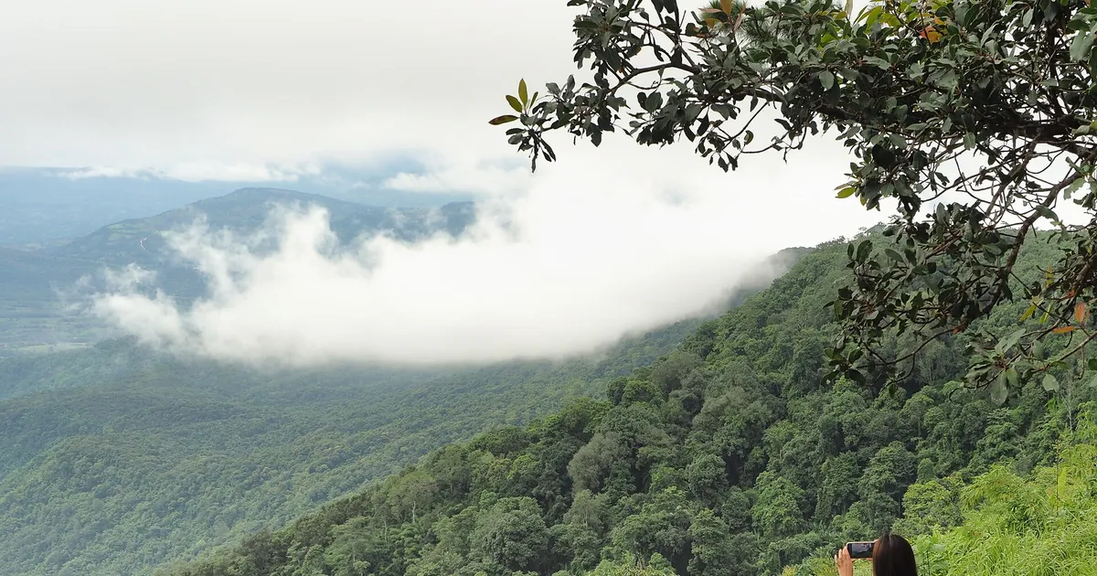
Phu Ruea, Loei 2026: Sea of Mist, the Summit & a 2-Day Plan
Guide to Phu Ruea National Park in Loei for the 2026 cool season: entry fees, reaching the 1,365 m summit, Wat Pa Huai Lat, a 2-day plan and camping warnings.
Umphang, Tak 2026 Guide: Thi Lo Su & 1,219 Curves
A practical Umphang (Tak) travel guide: Thi Lo Su waterfall is open again, the 1,219-curve road, entry fees, rafting, Doi Hua Mot mist, best season and a 3-day plan.
Khao Kho Travel Guide 2026: Sea of Mist, Wat Pha Son Kaew, Fees
Khao Kho, Phetchabun in the cool season 2026: sea of mist at Khao Takhian Ngo, Wat Phra That Pha Son Kaew, Sri Dit Waterfall, fees, stays and a 2-day plan.